Sahra & BeyondSahra& Beyond
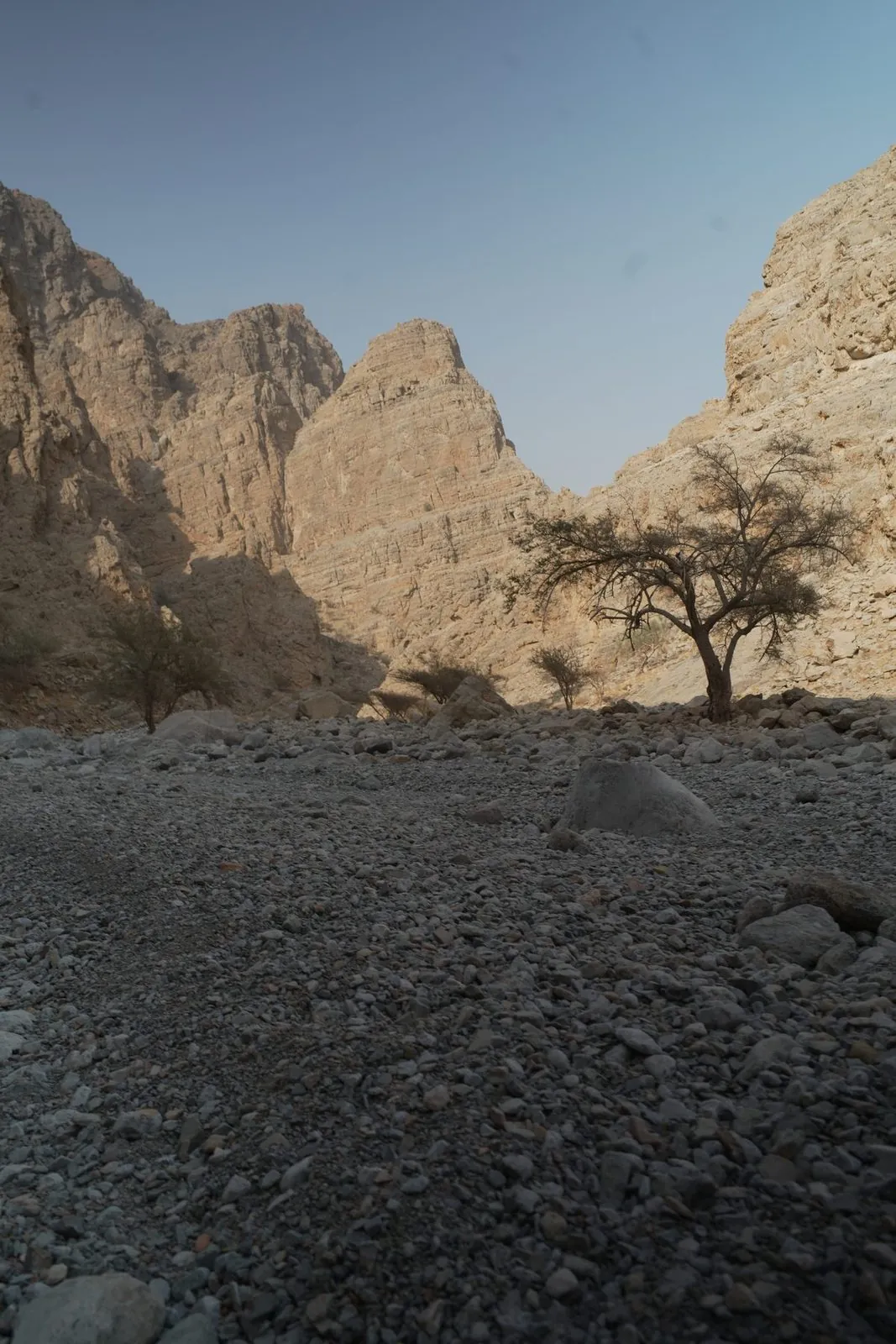
The rocky bed of Wadi Naqab between steep pale rock cliffs, with a lone acacia

Wadi Naqab

Hajar Mountains, off the Wadi Naqab road at Al Salihia (right off Street 33C from RAK city) · Ras Al Khaimah

MountainsHardBest Oct–Apr
Loading live weather…
Getting thereSUV or 4x4For the last stretch to the trailhead; the hike is on foot, never alone
Time needed6–12 hours
Best timeStart at first light; be off the trail before dark
CostFree; groups of 10+ notify RAK tourism
Toilets NoneFood NoneShade Some
  1. January: best
  2. February: best
  3. March: best
  4. April: possible
  5. May: avoid
  6. June: avoid
  7. July: avoid
  8. August: avoid
  9. September: avoid
  10. October: possible
  11. November: best
  12. December: best

Wadi Naqab cuts through the Hajar Mountains of Ras Al Khaimah, into the slopes of Yanas Mountain (Jebel Yanas) — the wadi and the peak share one mountain and one access road, rather than sitting in separate ranges. Red-rock walls close in around a seasonal watercourse that fills with pools after winter rain, and a small dam — 22 metres high — now sits across the lower gorge, built as part of a $44 million infrastructure package announced in 2020. The wadi is named for the Naqbiyin tribe, and its lower reaches hold around 60 Wadi Suq-era burial tombs, several thousand years old, a handful of them excavated by University of Durham archaeologists ahead of Ring Road construction. This is old, lived-in mountain country, not an empty backdrop.

Two routes are commonly walked from the trailhead. The Red Wall hike, marked with red paint on the left fork, is the shorter option at around six hours out and back, passing seasonal pools and small hillside settlements. A longer out-and-back route toward Sheri and Baqal villages runs closer to twelve hours over boulder fields and mountain ledges, and suits only fit, well-prepared hikers. Both are exposed in places, with scrambling, loose rock and stretches with real drop-offs, so a head for heights and proper footwear matter more here than on an easy wadi walk.

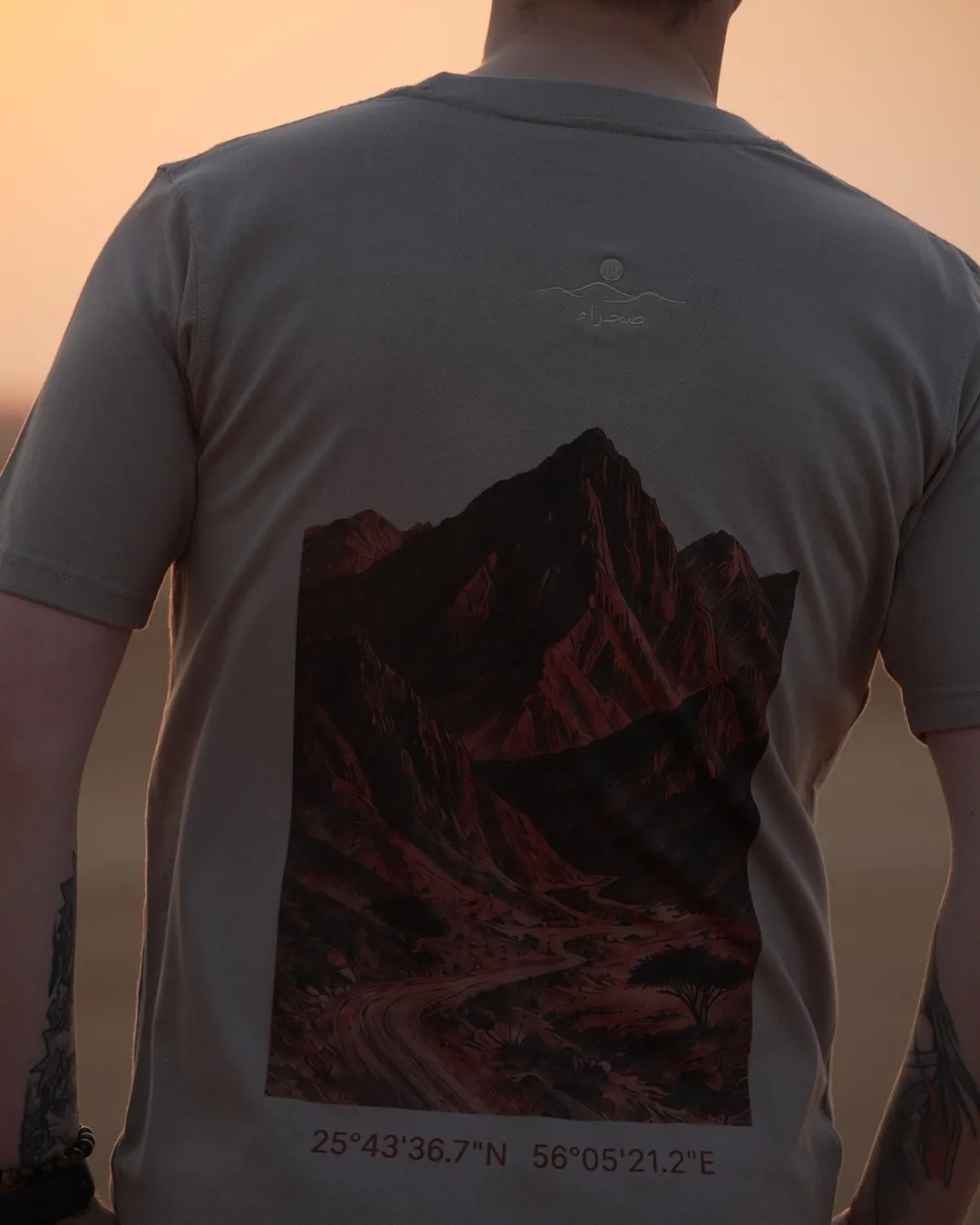
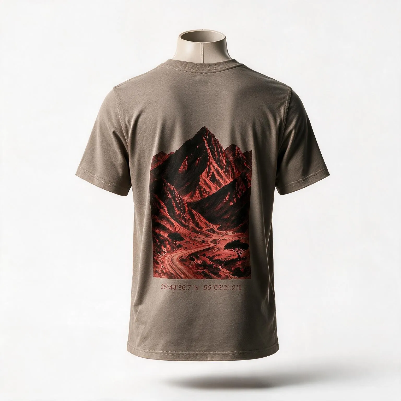
The peaks above this wadi are the ones traced on the Hajar Mountains tee — the ridge reduced to contour lines, printed across the back.

None of this is a manicured park. There's no shop, tap or shade shelter along the trail, so carry more water than you think you'll need, plus food, a map or GPS track, a torch and a basic first-aid kit, and tell someone your route before you go. Groups of ten or more are asked to notify Ras Al Khaimah's tourism authorities in advance; smaller groups need no permit.

The reward, on a clear winter evening, is real: the ridgelines catch the last light in deep red and gold, and the same isolation that makes daytime hiking hard here also makes for some of the darkest mountain skies in the emirate after dark. Come between October and April, skip it altogether if rain is forecast anywhere upstream, and treat the distance and difficulty as genuinely mountain-grade rather than a casual afternoon out.

Last checked 27 September 2026. Facts on this page come from the sources listed at the bottom. Spotted something out of date?

Getting there

The trailhead is reached by turning right off Street 33C from Ras Al Khaimah city at Al…
Dubai Wadi Naqab
95 km from Dubai as the crow fliesBy road: about 1h45–2h from Dubai

The trailhead is reached by turning right off Street 33C from Ras Al Khaimah city at Al Salihia, then following the road up into the Wadi Naqab gorge; RAK's tourism board puts the drive at around two hours from Dubai and about 40 minutes from RAK city. The final stretch is rough enough that a 4x4 or other high-clearance vehicle is strongly recommended, since regular cars struggle once the terrain turns to loose rock and gradient. There's no fuel, shop or public transport out here, so fill up in RAK city and buy any food and water you need before you leave town. Without your own vehicle, the practical options are a private taxi arranged for the return trip or a guided hiking tour that includes transport.

GPS 25.694806, 56.045361

When to go

Visit between October and April, when mountain temperatures are manageable for hours of…
  1. January: best
  2. February: best
  3. March: best
  4. April: possible
  5. May: avoid
  6. June: avoid
  7. July: avoid
  8. August: avoid
  9. September: avoid
  10. October: possible
  11. November: best
  12. December: best

Best Possible Avoid This month is marked

Visit between October and April, when mountain temperatures are manageable for hours of scrambling. RAK's tourism board stresses starting early and allowing plenty of daylight, since both main routes run six to twelve hours. Winter afternoons bring the best light on the red rock, especially in the last hour before sunset. Avoid the wadi entirely, whatever the season, if rain is forecast anywhere in the mountains — flash floods here can rise fast, and Ras Al Khaimah Police have carried out multiple rescues of stranded hikers in past years. Weekdays are quieter than weekends.

What to do there

On foot, Wadi Naqab is a proper mountain hike rather than a stroll: red sandstone walls,…

On foot, Wadi Naqab is a proper mountain hike rather than a stroll: red sandstone walls, boulder-hopping sections, and after rain a string of pools deep enough to wade in. The shorter Red Wall route (about six hours return) follows red trail markers past seasonal pools and small hillside settlements. The longer route toward Sheri and Baqal villages (around twelve hours return) pushes further into boulder fields and old mountain hamlets, with genuine exposure on some ledges. There's a small flood-control dam near the lower gorge, worth a look if you're not tackling the full trail. Expect scrambling rather than a marked path in the upper sections, and treat both routes as a half-day-to-full-day commitment, not a quick detour.

Safety and rules

Flash flooding is the real hazard: Ras Al Khaimah's tourism board warns that the wadi can…
Rain you cannot see, far upstream, can send water down a dry wadi in minutes. If rain is forecast anywhere in the mountains, stay out of wadis and off wadi floors.

Flash flooding is the real hazard: Ras Al Khaimah's tourism board warns that the wadi can fill with water quickly and says plainly never to hike here when rain is expected, anywhere upstream. Ras Al Khaimah Police have rescued stranded hikers more than once — nine people were found after a night stranded in December 2020, and three exhausted tourists were rescued at altitude in May 2023 — with officers repeatedly urging hikers to tell someone their route and to keep to it rather than push further into the heights and side valleys. Some sections are genuinely exposed, so a head for heights and solid footwear aren't optional. Never hike it alone, and carry more water than you expect to need, a torch, a first-aid kit and a way to navigate, and groups of ten or more should notify RAK's tourism authorities before setting out.

In an emergency
  • 999 Police
  • 998 Ambulance
  • 997 Civil Defence

Weather warnings: National Center of Meteorology. Tell someone where you are going and when you will be back.

Heritage, nature and etiquette

The wadi takes its name from the Naqbiyin tribe, who once worked this ground; by around…

The wadi takes its name from the Naqbiyin tribe, who once worked this ground; by around 1800 it had passed to the Habus, who grew wheat and dates here and traded across the region. Its lower reaches hold roughly 60 Wadi Suq-era burial tombs, several thousand years old, four of which University of Durham archaeologists excavated before Ring Road construction reached the site. Geologically, the wadi exposes rock from the Triassic–Jurassic boundary, around 200 million years old, with a genuinely rich fossil record for anyone interested in the ground beneath the trail.

Etiquette. This is still a working, inhabited mountain landscape rather than a wilderness park — keep to the marked routes near the small settlements en route, and pack out everything you bring in.

Hajar Mountains t-shirt, a mountain graphic tee in the regular fit — the red rock of the Hajar printed across the backHajar Mountains — Regular, regular fit, front view showing the set-in shoulder and classic cutThe Hajar Mountains tee worn in the dunes — the printed ridgeline across the back with the coordinates beneath itThe Hajar Mountains tee, front, worn in the dunes — the chest mark on the sand-coloured cotton
The tee drawn from this place

Hajar Mountains — Regular

Regular fit. A topographic line drawing of the Hajar peaks. 230gsm combed cotton, made to layer. Limited first run.

AED 199DTG print · embroidered logo✦ Limited first run
See the tee →

Also in Oversized

More mountain t-shirts

What to pack for Wadi Naqab

Matched to how you get there and how long you stay. Tap items as you pack them; this list is saved on your phone.

0 packed

Take this list with you

Send it to yourself or the people you are going with. Ticked items are marked.

Questions people ask about Wadi Naqab

Is Wadi Naqab safe to hike?

It can be, but take it seriously: routes are exposed with real scrambling, and Ras Al Khaimah Police have rescued stranded hikers here more than once. Never go if rain is forecast, and tell someone your planned route.

Do I need a permit for Wadi Naqab?

No, not for a normal-sized group. Groups of ten or more are asked to notify RAK's tourism authorities before visiting.

How do I get to Wadi Naqab?

Turn right off Street 33C from RAK city at Al Salihia. The drive is about two hours from Dubai or 40 minutes from RAK city, and the final stretch needs a 4x4 or high-clearance vehicle.

How long does the hike take?

The main Red Wall route is around six hours return; the longer route to Sheri and Baqal villages runs closer to twelve hours.

Are there toilets or shops at Wadi Naqab?

No — there are no facilities on site, so bring all the food, water and supplies you'll need.

When's the best time to visit?

October to April, for cooler temperatures — and always check the forecast first, since this wadi floods quickly after rain.

SourcesWhere the facts on this page come from