
Sahra & BeyondSahra& Beyond
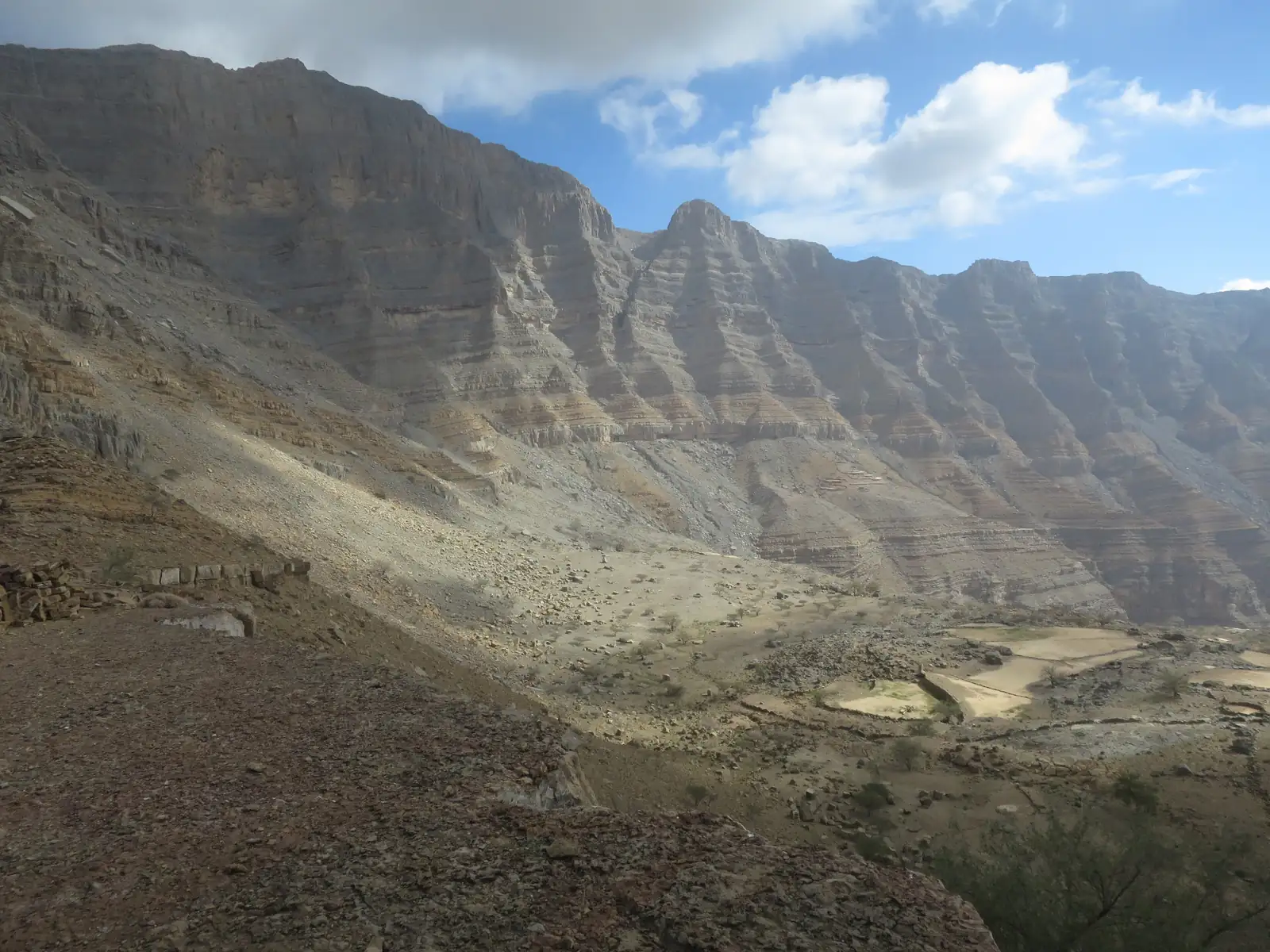
A layered limestone wall of the Hajar Mountains near Jebel Jais, with old terraced fields below

Hajar Mountains

جبال الحجر

Northern UAE, from Ras Al Khaimah through Sharjah and Fujairah to Hatta, continuing across the border into Oman · Ras Al Khaimah, Fujairah, Sharjah & Dubai (Hatta)

MountainsVariesBest Oct–Apr
Loading live weather…

Photo: Angela Manthorpe, CC BY-SA 4.0, Wikimedia Commons (resized)

Time neededHalf a day to a full day per area
Best timeOctober to April; avoid wadis if rain is forecast
CostVaries; Wadi Wurayah tours from Dh300 a person
Food Some
  1. January: best
  2. February: best
  3. March: best
  4. April: possible
  5. May: avoid
  6. June: avoid
  7. July: avoid
  8. August: avoid
  9. September: avoid
  10. October: possible
  11. November: best
  12. December: best

Quick answers

Where is it?
A range of about 700km that crosses the northern UAE into Oman, on the north-east corner of the Arabian Plate.
How big is it?
About 700km long and roughly 100km wide overall. The highest point, Jebel Shams (3,009m), is in Oman; the UAE's high ground is lower.
Where can I see it from the UAE?
Jebel Jais, Jebel Yanas and Wadi Naqab in Ras Al Khaimah, the wadis of Fujairah, and Hatta. Jebel Hafeet near Al Ain is an outlier.
Best months
October to April, early in the day. Summer is too hot for hiking.
Do I need a 4x4?
It depends on the place. Visit Ras Al Khaimah recommends one for the final stretch to the Wadi Naqab trailhead.
Permits and fees
No permit at Wadi Naqab for small groups; Wadi Wurayah is by controlled tour (from Dh300 a person in July 2026). Check each place.
Is Jebel Hafeet part of it?
Wikipedia says it is often considered an outlier of the Hajar, so it is treated here as a separate stop near Al Ain.

The Hajar Mountains are a range of about 700 kilometres and roughly 100 kilometres wide, on the north-east corner of the Arabian Plate, running from the Musandam Peninsula in the north to Oman's east coast, according to Wikipedia. The name, Jibal al-Hajar (جبال الحجر), is usually translated as the Rocky or Stone Mountains. The UAE holds only the northern part. Bayut's guide lists Ras Al Khaimah, Fujairah, Sharjah and Dubai among the emirates the range extends into, and the highest point of the whole range, Jebel Shams at 3,009 metres, is in Oman. UAE heights are lower: Jebel Jais is quoted at 1,934 metres by Visit Ras Al Khaimah, although Wikipedia says its summit sits on the Omani side and gives 1,892 metres for the highest point inside the UAE.

The rock is the reason the range is of interest to geologists. The Semail Ophiolite here is described as the most complete ophiolite on Earth: a slice of ancient ocean floor pushed up onto the continent tens of millions of years ago. At Wadi Wurayah in Fujairah it is exposed at the surface. At Wadi Naqab, Wikipedia says the rock exposes the Triassic to Jurassic boundary, about 200 million years old, with abundant fossils.

From the UAE, the range is best understood as a set of separate entry points rather than one destination. In Ras Al Khaimah, Jebel Jais is the developed one, with a zipline, a restaurant and marked hiking trails, while Wadi Naqab and the Jebel Yanas ridge above it are rougher and more demanding; Bayut also lists Wadi Bih and Wadi Shawka in the emirate. In Fujairah, the mountains run close to the east coast, and Wadi Wurayah is the best-documented site: the UAE's first national park (2013), a Ramsar wetland (2010) and, according to The National, added to the UNESCO World Heritage List in July 2026. Bayut also names Wadi Al Hayl and Wadi Siji in Fujairah. Hatta, a mountain exclave of Dubai, has its own page. Jebel Hafeet, near Al Ain, is often considered an outlier of the Hajar rather than part of the main range, and its rock is different: a fold of limestone, marl and evaporites.

The practical points are weather and timing. Jebel Jais is usually about 10°C cooler than other parts of Ras Al Khaimah, and Wikipedia gives it an average annual rainfall of 129mm. Rain is the main hazard: the National Centre of Meteorology warned of flash floods and landslides in the Fujairah and Masafi hills in October 2025, and Gulf News reported rocks falling on mountain roads there. Visit Ras Al Khaimah says summer is unsuitable for hiking at Wadi Naqab because of the heat, and puts the season at October to April.
Last checked 1 October 2026. Facts on this page come from the sources listed at the bottom. Spotted something out of date?

Getting there

There is no single route, because the range is crossed by several roads and reached from…
Dubai Hajar Mountains
95 km from Dubai as the crow fliesBy road: Varies by access point; Wadi Naqab is about 2 hours from Dubai and 40 minutes from Ras Al Khaimah city

There is no single route, because the range is crossed by several roads and reached from several emirates. Wadi Naqab, in Ras Al Khaimah, is reached from Street 33C at Al Salihia and is about 2 hours from Dubai and 40 minutes from Ras Al Khaimah city, according to Visit Ras Al Khaimah, which recommends a 4x4 for the last kilometres to the trailhead. Jebel Jais, Jebel Yanas, Hatta and Jebel Hafeet each have a page here with their own directions and road conditions. In Fujairah, Wadi Wurayah is roughly 45km from Fujairah city and is visited on controlled group tours booked through Fujairah Holidays, according to Khaleej Times; the Bayut guide says the park's administration issues permits, so confirm the current arrangement before travelling. A car is the practical choice for most of the range, and no public transport to these places is described.

GPS 25.694806, 56.045361

When to go

October to April is the season given by Visit Ras Al Khaimah for Jebel Jais and Wadi…
  1. January: best
  2. February: best
  3. March: best
  4. April: possible
  5. May: avoid
  6. June: avoid
  7. July: avoid
  8. August: avoid
  9. September: avoid
  10. October: possible
  11. November: best
  12. December: best

Best Possible Avoid This month is marked

October to April is the season given by Visit Ras Al Khaimah for Jebel Jais and Wadi Naqab, and Bayut gives October to March for Fujairah's wadis. Summer is the wrong time for hiking: Visit Ras Al Khaimah calls it unsuitable at Wadi Naqab because of the heat, and even the cooler high ground can be warm, with a June record of 36.5°C recorded on Jebel Jais. Winters are cool at height. Wikipedia lists a record low of -5.7°C on Jebel Jais, in February, and notes snow there in January 2009 and January 2020. Start early, and check the forecast for the whole mountain area, not only the place you are visiting.

What to do there

What to do depends on the part of the range. Jebel Jais offers viewpoints, a zipline, the…

What to do depends on the part of the range. Jebel Jais offers viewpoints, a zipline, the 1484 by Puro restaurant and six hiking trails totalling 16km, according to Visit Ras Al Khaimah. Jebel Jais was reported closed for seasonal maintenance in September 2026; check visitjebeljais.com before going. Wadi Naqab and the ridge of Jebel Yanas are the places for a hard day on foot or a rough drive. Hatta offers a reservoir and the mountain setting close to Dubai. In Fujairah, a Wadi Wurayah tour includes a hike of about 2.5km to freshwater pools and a 13-metre waterfall, according to Khaleej Times, while The National calls the waterfall the UAE's only permanent natural one. Jebel Hafeet, near Al Ain, is the separate outlier with its own road and tombs. For the details of each, use the individual guides rather than treating them as one trip.

Safety and rules

Flash floods are the main hazard. Visit Ras Al Khaimah says Wadi Naqab can fill with…
Rain you cannot see, far upstream, can send water down a dry wadi in minutes. If rain is forecast anywhere in the mountains, stay out of wadis and off wadi floors.

Flash floods are the main hazard. Visit Ras Al Khaimah says Wadi Naqab can fill with water quickly and that you should not hike it when rain is expected. Gulf News reported in October 2025 that the National Centre of Meteorology warned of flash floods and landslides in low-lying and hilly areas, and that residents were advised to stay clear of wadis and low-lying areas. Rockfall is a second risk: the same report described rocks falling on mountain roads at Masafi in Fujairah, and motorists were told to reduce speed and take extreme caution. Heat is the third: summer is unsuitable for hiking, and the exposed rock offers little shade. For hikes, Visit Ras Al Khaimah advises carrying extra water, emergency food, layers, sun protection, offline maps, a torch and first aid. Tell someone your route before you go.

In an emergency
  • 999 Police
  • 998 Ambulance
  • 997 Civil Defence

Weather warnings: National Center of Meteorology. Tell someone where you are going and when you will be back.

Heritage, nature and etiquette

The mountains hold a good deal of wildlife for a dry region. Wikipedia lists the Arabian…

The mountains hold a good deal of wildlife for a dry region. Wikipedia lists the Arabian tahr and mountain gazelle among the range's fauna, and reports an Arabian caracal sighting in February 2019. The National says Wadi Wurayah is home to wild Arabian tahr, an Arabian caracal rediscovered in 2025 and Blanford's fox. For vegetation, Wikipedia describes shrubland at low elevations giving way to woodland with wild olive and fig trees, and junipers higher up. The human history is old too: Wikipedia says the foothills of Jebel Hafeet contain about 500 beehive tombs from the Hafit period (3200 to 2600 BCE). Wadi Wurayah became a national park in 2013, and its Ramsar listing dates from 2010.

Etiquette. Treat the protected sites as protected. Wadi Wurayah is visited in controlled groups, and Khaleej Times explains this as a way of preventing damage to a sensitive ecosystem. At Wadi Naqab, groups of ten or more are asked to contact the authorities in advance. Carry your rubbish out, keep to established routes near the small mountain settlements, and leave wildlife and archaeology undisturbed.

Wear the place

Hajar Mountains — Regular

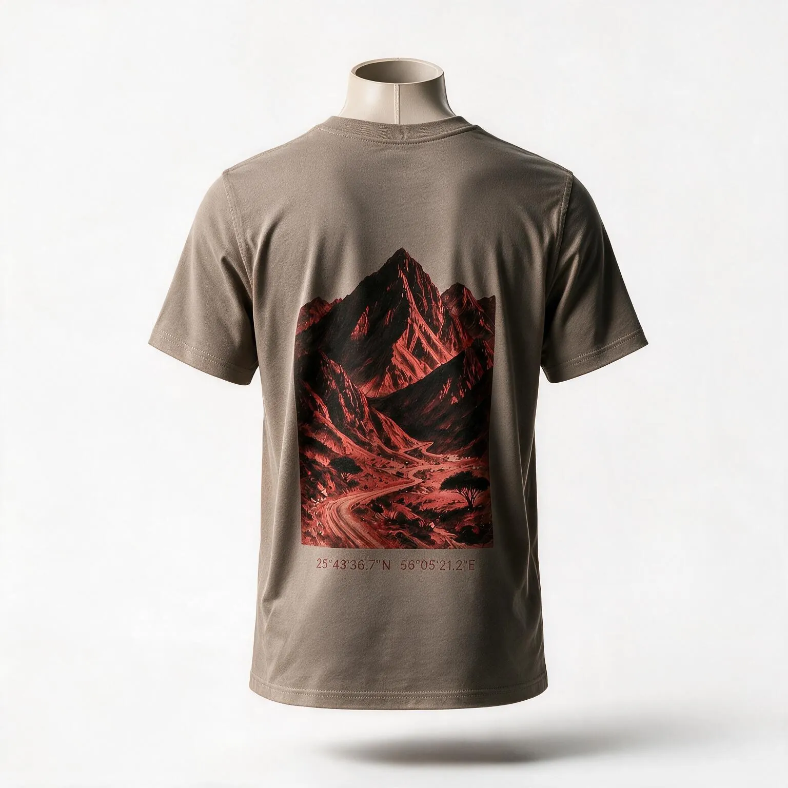
The peaks traced on the Hajar Mountains tee are drawn from the range above Wadi Naqab in Ras Al Khaimah, one stretch of the Hajar rather than the whole range.

AED 199 · 230gsm cotton · any 2 tees AED 359· 230gsm cotton

See the tee →

What to pack for Hajar Mountains

Matched to how you get there and how long you stay. Tap items as you pack them; this list is saved on your phone.

0 packed

Take this list with you

Send it to yourself or the people you are going with. Ticked items are marked.

Questions people ask about Hajar Mountains

Where are the Hajar Mountains?

They run for about 700km from the Musandam Peninsula to Oman's east coast. The UAE holds the northern part, which Bayut says reaches Ras Al Khaimah, Fujairah, Sharjah and Dubai (at Hatta).

What is the highest point of the Hajar Mountains in the UAE?

It depends on the source. Visit Ras Al Khaimah gives 1,934m for Jebel Jais; Wikipedia says that summit is on the Omani side and gives 1,892m for the UAE's highest point. The highest point of the whole range, Jebel Shams, is in Oman at 3,009m.

Where is the best place to see the Hajar Mountains from the UAE?

It depends on what you want. Jebel Jais is the developed option with viewpoints and activities, Wadi Naqab and Jebel Yanas suit hikers and rough-road drivers, Hatta is a mountain exclave of Dubai, and Fujairah has the wadis. Each has its own guide on this site. Jebel Jais was reported closed for seasonal maintenance in September 2026; check visitjebeljais.com before going.

What can I visit in the Fujairah mountains?

Wadi Wurayah is the best documented: the UAE's first national park, with a 13-metre waterfall, and visited on controlled tours that Khaleej Times said start from Dh300 a person. Bayut also lists Wadi Al Hayl and Wadi Siji. The Fujairah mountain roads near Masafi saw rocks fall on the road in October 2025, so check conditions after rain.

Is Wadi Wurayah open to visitors?

Khaleej Times (July 2026) says the reserve reopened in January 2026 for controlled group tours booked with Fujairah Holidays, after being closed to tourists since 2013. Bayut's guide says permits come from the park administration. Confirm the current arrangement before you plan a trip.

Is Jebel Hafeet part of the Hajar Mountains?

Wikipedia says it is often considered an outlier of the Hajar Mountains rather than part of the main range. It stands at 1,249m on the Oman border near Al Ain and is a fold of limestone, marl and evaporites.

When is the best time to visit the Hajar Mountains?

October to April for Jebel Jais and Wadi Naqab (Visit Ras Al Khaimah), and October to March for Fujairah's wadis (Bayut). Summer is unsuitable for hiking, and rain brings flash floods.

Is it safe, and what is the wildlife like?

The main risks are flash floods, rockfall on mountain roads and heat, so avoid wadis when rain is forecast. Wildlife includes the Arabian tahr, mountain gazelle, caracal and Blanford's fox, though sightings are not guaranteed and the best-protected habitat, Wadi Wurayah, is visited only on controlled tours.

SourcesWhere the facts on this page come from