
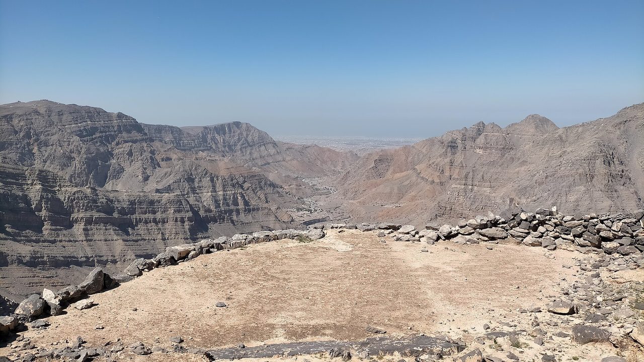
Wadi Qada'ah is a dry valley east of Ras Al Khaimah city. The walk described in most detail by walkers starts at Danam village and climbs about 650m in 3.4km to the mountain village of Qada'ah, then returns the same way. It is steep and loose, the last part is unmarked, and police have rescued hikers from the wadi several times since 2021.
Why it is graded Difficult
No official grade exists. We rate it Difficult because the one recorded track climbs about 650m in 3.4km each way on steep, loose ground, with a near-vertical start, short exposed sections and an unmarked last stretch. Police have rescued hikers from the wadi several times since 2021.
We use one scale across all our routes: how we grade.
The route
You drive up Wadi Qada'ah and follow an almost 8km dirt track from the Wadi Qada'ah Dam to Danam, a village on the wadi bank. Parking is reported a few metres before the trailhead.
The walk starts with a near-vertical climb beside a dry waterfall about 50m high, helped by cemented stone steps. Higher up the steps thin out and the path zigzags over dirt and rock, with a lot of loose small stone and a few slightly exposed sections.
The path reaches Qada'ah village on a high plateau, with dry-stone ruins, cisterns and terraces. The last stretch before the village is unmarked and the path is poorly defined. The homes are private, mostly second homes. You return the same way.
- Distance
- About 6.8km out and back, from one recorded walker's track. No official figure exists.
- Climb
- About 650m of climbing, from the same track. It runs from about 290m to 885m above sea level.
- Time
- Not confirmed. The one recorded track shows 2 hours 24 minutes of moving time, with long stops bringing the total to 7 hours 41 minutes.
Trailhead
- Start
- Danam (Dhanab) village on Wadi Qada'ah, east of Ras Al Khaimah city. Parking is reported a few metres before the trailhead.
- Coordinates
- 25.75745, 56.12791
The pin comes from one walker's track on Wikiloc and has not been checked on the ground. It is accurate to a few hundred metres at best. - Parking
- Not confirmed. A recorded track puts the parking just before the trailhead. No authority describes it. Check before you go.
- Vehicle
- Not confirmed. The track source says a 4x4 is ideal for the almost 8km dirt track, and that heavy rain can make it impassable. A low sedan may pass slowly.
- Getting there
- Wikipedia puts Wadi Qada'ah about 10km east of Ras Al Khaimah city. No drive time was found. The dirt track adds to the journey.
When to go
- Best months
- Cooler months, November to March, according to a walker's track on the nearby Silay Al Khatami route. No source gives a season for this route. Do not walk it in summer.
- Start time
- Start early and finish well before dark. Police ask hikers to avoid the mountains in the heat of the day.
- Shade
- Not confirmed. Assume little.
- Water
- No water source is confirmed. Carry everything you need.
- Mobile signal
- Not confirmed. Assume none and download an offline map.
Fees, permits, hours and closures
- Fees
- No entry fee or parking charge was found. Last checked October 2026.
- Permits
- No hiker permit was found. Organisers of treks need a RAKTDA permit, the tourism authority says (Khaleej Times, February 2021). The houses in Qada'ah village are privately owned, mostly second homes, and whether walkers may enter the village is not confirmed. Last checked October 2026.
- Hours
- No hours are published. This is not an operated site. Last checked October 2026.
- Closures
- Not confirmed. After the late-March 2026 floods, roads in Ras Al Khaimah were closed and police urged people to avoid mountain areas (Emarat Al Youm, 28 March 2026). That report does not name this route or its access track. Check with RAK Police before you go. Last checked October 2026.
Checked on 8 October 2026. Rules and closures change, above all after rain: check the source pages below on the day.
Safety
- Do not go in or after rain. Wadi Qada'ah flooded the Emirates Street bypass in late March 2026, and rain can make the access track impassable.
- Police have airlifted lost or exhausted hikers from Wadi Qada'ah in January 2021, February 2022, August 2022 and August 2023. Two of those cases involved sun exposure.
- Do not walk in summer. Police ask hikers to avoid the mountains in the heat of the day.
- The climb is steep with loose stone and a few exposed sections. A slip can cause a serious accident. Wear boots with good grip.
- The last stretch before the village is unmarked. Load an offline track, or go with a licensed guide if you have not walked it before.
- Carry all your water and food, go with a companion, and tell someone your route and return time. Do not rely on mobile signal.
- Qada'ah has houses that are privately owned, mostly second homes, near the Oman border. Do not enter houses or damage terraces, and do not go towards the border.
What to carry
- All your water, plus a spare litre
- Food and a rehydration drink
- Offline map and GPS track
- Sturdy boots with good grip
- Trekking poles
- Sunscreen, hat and sunglasses
- First aid kit
- Charged phone and power bank
Tell someone your route and when you expect to be back. Turn around if the weather, the heat or the time is against you. We describe this route from published sources; we have not surveyed it, and nothing here is a statement that it is safe for you on the day.
Police 999 · Ambulance 998 · Civil Defence 997
What we could not confirm
- Which walk the name 'Wadi Qada'ah' means. Several routes start in this wadi, and no official source names one. This page covers Danam to Qada'ah village.
- Whether the track and the route are open. Roads were closed and police urged people to avoid mountain areas after the March 2026 floods, and no notice about this route was found.
- Access and permission. Signs limit vehicles on a nearby track to village residents, and no source says whether walkers need permission.
- The trailhead, parking and drive time. They come from one walker's track and no authority.
- Distance, climb and time. They come from a single recorded track.
Sources
- Wikipedia: Wadi Qada'ah (location, 15.3km length, intermittent flow, spellings, rescue reports cited)
- Wikipedia: Qada'ah (village, 870m, coordinates, about 20 houses, donkey path from Danam, Oman border)
- Wikiloc track via loc.wiki mirror: Danab (Danam) to Qada'ah village (6.79km, 650m, route, warnings, 4x4 notes, parking coordinates)
- Wikiloc track via loc.wiki mirror: Wadi Qada'ah to Silay Al Khatami (11.76km, access restrictions on the track)
- Wikiloc track via loc.wiki mirror: Wadi Qadaah to Ghail village (7km, Patrick's Hikes; 4x4 access, faint trail)
- Wikiloc track via loc.wiki mirror: Jebel Qada'ah routes 1 and 2 (summit routes from the wadi)
- The National: RAK Police rescue seven hikers lost in Wadi Qada'a (22 February 2022)
- Gulf News: Five Asians lost atop RAK mountain rescued (Wadi Qada'a, 28 August 2022)
- Al Bayan: five Asians lost in Wadi Qada'a (28 August 2022, Arabic)
- Dubai Eye 103.8: Stranded teenagers rescued from Ras Al Khaimah mountains (Wadi Quda'ah, 17 August 2023)
- Gulf Today: RAK Police airlift 3 exhausted Arab trekkers (Wadi Qada'ah, 18 January 2021)
- Emarat Al Youm: Air Wing rescues 3 tourists in Wadi Qada'a (18 January 2021, Arabic)
- Gulf News: Three exhausted tourists stuck in RAK mountains rescued (19 January 2021; names Wadi Al-Baih, mentions Wadi Qada)
- Emarat Al Youm: mountain tracks closed in Ras Al Khaimah and the Eastern Region (28 March 2026, Arabic; Wadi Bih and Wadi Qada'ah flood Emirates Street)
- Khaleej Times: Dh10,000 fine for organising treks in RAK without a licence (20 February 2021)
- Climbing7: Leopard Canyon, Ras Al Khaimah (start at the border control tower at the end of Wadi Qada'a)
- Visit Ras Al Khaimah: Hiking blog (checked; does not list Wadi Qada'ah)
- Ajman government: emergency numbers
- Wikimedia Commons: File:View of Wadi Qada'ah from Qada'ah Village.jpg (CC0, IbrahimKumar)
Last checked 8 October 2026