
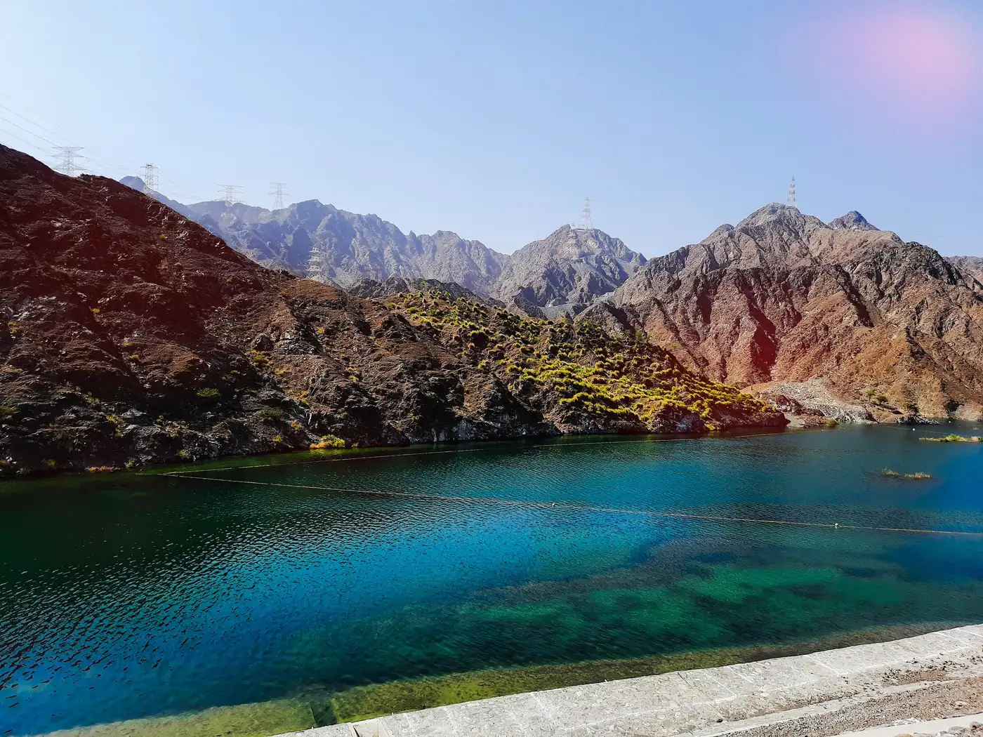
The marked trail from Al Rafisah Dam climbs about 3 km through the Hajar Mountains to the Al Suhub Rest House, rated easy to moderate by Visit Sharjah and taking about 3 hours there and back. You start beside the lake and end with a view over Khor Fakkan and the Gulf of Oman.
Why it is graded Moderate
Visit Sharjah calls the trail easy to moderate but gives no numeric grade. Graded Moderate here for the sustained climb to a rest house at about 580 m, with steep sections and loose rock.
We use one scale across all six routes: how we grade.
The route
You start at Al Rafisah Dam, on the walkway of palm trees and benches leading towards the mountain edge. Visit Sharjah says this walk begins the longer hike. Follow the signs and its map. The first junction is not confirmed.
The path is a zig-zagging mountain trail that climbs steadily, with steep sections and loose rock (Glimpses of UAE). Visit Sharjah calls it well marked, with benches along the way. No source describes the waymarks.
The turn-around is the Al Suhub Rest House, about 580 m above sea level, with a restaurant and views over Khor Fakkan and the Gulf of Oman. Return the same way. A road also reaches the rest house, so do not mistake its traffic for the trail.
- Distance
- The National (2021) gives about 3 km one way, so about 6 km return. Glimpses of UAE gives 7.5 km.
- Climb
- Glimpses of UAE reports about 440 m of ascent, Sharjah24 600 m. Neither is official.
- Time
- Visit Sharjah gives about 3 hours round trip, allowing 1 to 1.5 hours each way.
Trailhead
- Start
- The walkway at the dam wall. Visit Sharjah marks the start on its map; the exact point is not confirmed.
- Coordinates
- 25.34885, 56.31126
The pin is the dam wall from OpenStreetMap, not a surveyed trail start or car park. - Parking
- Car park at the dam, 45 spaces (Wikipedia). Paid 8am to 10pm daily, from Dh2 an hour (The National, 2022). Can fill at weekends.
- Vehicle
- 2WD. The road to the dam is sealed; the trail is on foot.
- Getting there
- Sustain Sharjah says the dam is about 45 minutes from Sharjah city.
When to go
- Best months
- November to March. Avoid May to September.
- Start time
- No source gives a start time. Start early, before the sun is high, and finish before dark.
- Shade
- Unknown. No source documents shade on the climb, so plan for little.
- Water
- Unknown on the trail. The rest house has a restaurant and the dam park a mini mart. Carry your own.
- Mobile signal
- Unknown. Sharjah24 and Visit Sharjah say coverage is good, but this is unverified. Do not rely on it.
Fees, permits, hours and closures
- Fees
- Dam park and rest house entry are free. Parking is paid, from Dh2 an hour (The National, 2022). No trail fee was found. Last checked October 2026.
- Permits
- None found. No source mentions a permit. Last checked October 2026.
- Hours
- The dam park is described as open 24/7 (UAE East Coast Tourism). Visit Sharjah gives no trail hours. Rest house hours vary. Last checked October 2026.
- Closures
- Not confirmed either way. No closure was found for the dam or trail on 6 October 2026. Check before you go, as rain damage or works could close it. Last checked October 2026.
Checked on 6 October 2026. Rules and closures change, above all after rain: check the source pages below on the day.
Safety
- Flash floods: the dam is at the head of a wadi. Check the forecast and avoid the trail in or after heavy rain.
- Heat: avoid May to September. The climb is several hundred metres with no documented shade.
- Terrain: steep sections and loose rock are reported. Wear sturdy hiking shoes with grip.
- Water: carry more than you think you need (Visit Sharjah). If short of water, turn back.
- Navigation: waymarks are undocumented, so carry an offline map. Tell someone your route; take a friend unless very experienced.
What to carry
- Water, more than you think you need
- Sturdy hiking shoes
- Sun hat and sun cream
- Offline map or downloaded route
- Charged phone
- Snacks
- Small first-aid kit
- Bag for your rubbish
Tell someone your route and when you expect to be back. Turn around if the weather, the heat or the time is against you. We describe this route from published sources; we have not surveyed it, and nothing here is a statement that it is safe for you on the day.
Police 999 · Ambulance 998 · Civil Defence 997
What we could not confirm
- Opening hours: none are published for the trail.
- Exact trailhead: the pin marks the dam wall, not a surveyed trail start.
- Parking rates: figures date from 2022 and are not confirmed for 2026.
- Climb: sources disagree, 440 m against 600 m, and neither is official.
- Waymarking, shade, water and signal: no source documents them.
Sources
- Visit Sharjah - Al Rafisah Hiking Trail
- Visit Sharjah - Al Rafisah Hiking Trail (activities page)
- Visit Sharjah - The Walk
- Visit Sharjah - About Al Rafisah Dam
- Visit Sharjah - Al Rafisah Dam activities (Wadi Shees and Al Rabi trails)
- Visit Sharjah - Najd Al Maqsar Village
- The National - Sharjah Ruler opens mountain-top destination (15 July 2021)
- The National - Khor Fakkan paid parking (6 August 2022)
- Glimpses of UAE - Rafisa Dam (trail 7.5 km round trip, 440 m, boat prices and hours)
- Sharjah24 - Al Rafisah Dam (600 m ascent)
- UAE East Coast Tourism - Al Rafisah Dam (24/7, no entry fee, paid parking)
- Trip.com - Al Rafisah Dam listing
- Sustain Sharjah - Al Rafisah Dam
- Property Finder - Al Suhub Rest House (3 km trail, hours)
- Bayut MyBayut - Al Suhub Rest House (3 km path)
- Khor Fakkan Tours - Al Suhub Rest House (hours, free entry)
- Wikipedia - Al Suhub Rest House
- Wikipedia - Al Rafisah Dam
- Wikipedia - Wadi Shie
- Wikipedia - List of emergency telephone numbers
- At World's Origins - Al Rafisah Dam (the Walk, footwear)
- Gulf News - Khorfakkan Road temporary closure, January 2026
- OpenStreetMap Nominatim - Al Rafisah Dam and Najd Al Maqsar Heritage Village
Last checked 6 October 2026 · Route 4 of 6 · www.sahraandbeyond.ae/h/4