
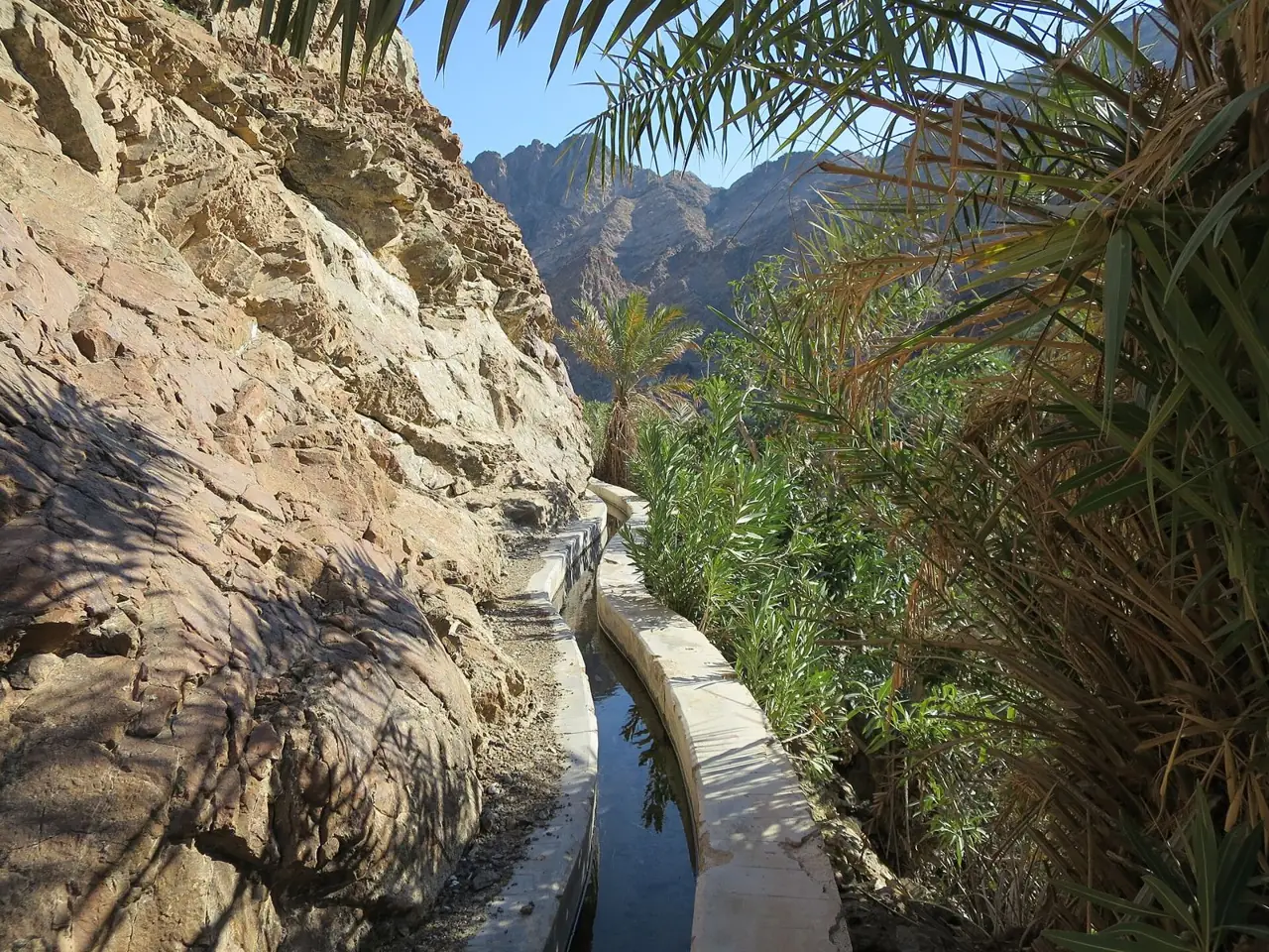
The Wadi Shees Nature Trail is a 1.8 km loop through Shees village in the Hajar Mountains near Khor Fakkan, following an ancient falaj water channel past terraced farms and palm groves. Visit Sharjah gives the walk as 30 to 40 minutes.
Why it is graded Easy
No authority grades this trail. Visit Sharjah calls the 1.8 km loop accessible and family-friendly but gives no grade. Easy is a judgement from the short distance, one flight of steps and village paths that blogs call beginner level with uneven ground.
We use one scale across all six routes: how we grade.
The route
You start at the car park at the foot of Shees village. The path crosses the wadi bed at a ford, then climbs a flight of stone steps to the old village. Glimpses of UAE counts over 100 steps and mentions an easier way up.
Above the steps you follow village paths beside a falaj, an ancient water channel. Visit Sharjah describes terraced farms, palm groves and archaeological remnants. Broken Boots Travel says the ground can be uneven. People live here, so stick to the main path.
The walk returns to the village car park, completing the 1.8 km loop. Keep an offline map on your phone. Do not follow the wadi bed beyond the village; it is not part of the trail and carries flood risk.
- Distance
- Visit Sharjah gives 1.8 km for the full loop. No authority publishes a map or track, so the exact line is not measured.
- Climb
- No source publishes a total climb. Glimpses of UAE counts over 100 steps up to the old village.
- Time
- Visit Sharjah gives 30 to 40 minutes. Blogs report 45 minutes to 2 hours with stops, so allow an hour.
Trailhead
- Start
- Shees village car park, where blogs report a large sign or information board.
- Coordinates
- 25.29111, 56.24462
The pin comes from OpenStreetMap and geotagged photos, within about 50 m. No authority publishes coordinates. - Parking
- Not confirmed whether the trail car park is paid. Shees Park nearby is paid by meter or SMS, so carry coins and a phone.
- Vehicle
- 2WD. The start is a village car park on a paved road. Visit Sharjah says four-wheel drive is for off-road wadi areas only.
- Getting there
- Blogs and press give about 60 minutes from Dubai (Sports Travel Tom, unverified) to 1 to 2 hours from the major emirates (Gulf News). Sports Travel Tom says there are no petrol stations on the S142, so fill up first.
When to go
- Best months
- October to April; winter is best.
- Start time
- Go early morning or late afternoon in warmer months. It is busiest at weekends and holidays.
- Shade
- Some. Visit Sharjah mentions shaded palm groves. Sources disagree on how much shade, and the steps are not described as shaded.
- Water
- A channel and stream run beside the path, but no source says it is drinkable. Do not drink it; bring your own.
- Mobile signal
- Unknown. Visit Sharjah says signal is generally close at hand on its walks, but nothing covers this trail. Assume none.
Fees, permits, hours and closures
- Fees
- No fee for walking the trail was found. Property Finder and Sports Travel Tom say it is free. Shees Park nearby may charge entry; reports differ. Last checked October 2026.
- Permits
- No permit is mentioned by Visit Sharjah or any other source. Last checked October 2026.
- Hours
- Visit Sharjah gives no opening hours for the trail. One blog gives Shees Park as open about 7:30 am to 10:30 pm, which is not official. Last checked October 2026.
- Closures
- Unconfirmed: no official notice for the trail was found. Sharjah Police closed the Nahwa to Shis road in heavy rain on 7 January 2023. Check Sharjah Police or Khorfakkan Municipality after rain. Last checked October 2026.
Checked on 6 October 2026. Rules and closures change, above all after rain: check the source pages below on the day.
Safety
- Do not go during or after heavy rain. Wadi Shees is prone to flash floods.
- Stay out of riverbeds and wadi channels in bad weather. Follow official weather warnings.
- Over 100 stone steps and uneven ground: wear closed shoes with grip. Do not assume there are handrails.
- No authority publishes a map of the loop, and no waymarks are described. Keep an offline map.
- Summer heat is a risk. Walk early or late and carry water.
- You pass through an occupied village and working farms. Respect residents.
What to carry
- Plenty of water
- Sturdy shoes with grip
- Hat and sunscreen
- Snacks
- Small first-aid kit
- Offline map on a charged phone
- Bag for your rubbish
- Coins and a phone for parking
Tell someone your route and when you expect to be back. Turn around if the weather, the heat or the time is against you. We describe this route from published sources; we have not surveyed it, and nothing here is a statement that it is safe for you on the day.
Police 999 · Ambulance 998 · Fire and civil defence 997
What we could not confirm
- Whether the trail is open: no official notice was found. Check Sharjah Police or Khorfakkan Municipality, especially after rain.
- The exact trailhead: the pin comes from map data, not an authority. Shees Park is a different place, 0.9 km away.
- Whether the car park is paid, and the opening hours.
- The total climb: no source gives one.
- Waymarking along the loop: no source describes any.
Sources
- Visit Sharjah, Wadi Shees Nature Trail
- Visit Sharjah, Wadi Shees
- Visit Sharjah, Shees Village
- Visit Sharjah, Shees Park
- Visit Sharjah, hiking trails index
- Visit Sharjah, Al Rabi Hiking Trail
- Visit Sharjah, Al Rafisah Hiking Trail
- Visit Sharjah, Mleiha Fossil Rock Hiking Trail
- Sustain Sharjah, Wadi Shees Nature Trail
- Sharjah24, Sharjah Ruler inaugurates Shees Rest Area (27 Oct 2023)
- Sharjah24, Shis a fully-serviced tourist area (25 Nov 2024)
- Sharjah24, Shees Park: quiet solitude away from city life (28 Dec 2024)
- Sharjah24, Extreme rainfall in Khorfakkan (12 Feb 2024)
- Khaleej Times, Police announce closure of key roads in Sharjah (7 Jan 2023)
- Gulf News, Mobile police station set up in Shees tourist area (Nov 2024)
- Gulf News, Shees Rest Area guide (updated 12 Nov 2023)
- Gulf News, Khorfakkan paid parking from 15 August 2022
- OpenStreetMap, way 1257679719 Wadi Shees Hike (API)
- OpenStreetMap, map data around Shees village (API bbox)
- OpenStreetMap Nominatim search, Shees Park and Wadi Shees
- Property Finder blog, Wadi Shees (7 Jul 2025)
- Glimpses of UAE, Wadi Shees hiking and facilities (updated 29 Apr 2026)
- Sports Travel Tom, Wadi Shees Nature Trail guide (6 Apr 2026)
- Broken Boots Travel, Things to do in Wadi Shees
- The Sandy Times, Where to go hiking in the UAE (11 Jul 2024)
- Bayut MyBayut, Shees Park guide
- UAE Travel Mom, Shees Park
- Tripadvisor, Wadi Shees reviews
- Tripadvisor, Sheeh Park reviews
- Wikipedia, Shees Park
- Travel And Tour World, Sharjah adventure trails (10 Dec 2024)
- Ajman government, Handling Emergencies
- Wikimedia Commons API, file metadata for Shees falaj 01, Wadi Shees and Wadi Shees Sharjah Emirate
Last checked 6 October 2026 · Route 1 of 6 · www.sahraandbeyond.ae/h/1