
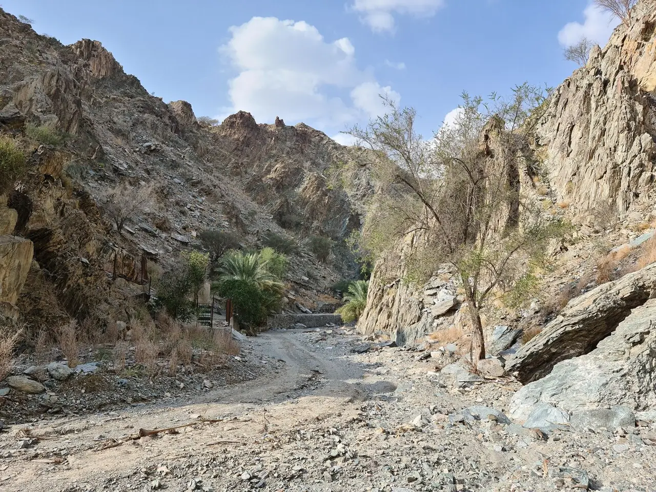
Al Taiba Trail runs through the farms, valleys and old village houses of Tayyibah near Masafi, and is one of the trails that Fujairah Adventures Centre grades Easy. The operator lists it at 4.5 km and 90 to 120 minutes, with the start in Al Taiba village.
Why it is graded Easy
Fujairah Adventures Centre, the emirate's official trail operator, grades Al Taiba Trail Easy, though its own description says easy to moderate, for family hikes and various fitness levels.
We use one scale across all six routes: how we grade.
The route
You start in Tayyibah (Al Taiba) village near Masafi, off the Dibba to Masafi road (E89). Press reports say the hike begins at the Flag Fort in the village. The operator's map pin is close to the Al Tayyibah Heritage Museum.
The operator describes mountain valleys, traditional farms and old clay and stone houses, but not the surface or gradients. A blog walker from the same village mentions hiking signposts, irrigation channels, an old graveyard and ruined houses.
The operator does not say whether the 4.5 km is a loop, an out-and-back or one way, or where it turns round. Follow the signs from the start, and keep time and energy for the way back.
- Distance
- Fujairah Adventures Centre gives 4.5 km but does not say whether that is one way or the whole route.
- Climb
- No source publishes the climb for the marked trail. A blog's 211 m is for a partly off-trail loop, so do not rely on it.
- Time
- Fujairah Adventures Centre gives 90 to 120 minutes.
Trailhead
- Start
- Tayyibah village, near Masafi. Press reports say the hike starts at the Flag Fort in the village.
- Coordinates
- 25.41339, 56.16762
The pin is the operator's own Google Maps place, near the Heritage Museum. It is not a labelled car park. - Parking
- Not confirmed. The National says the new trails have parking, but not where. Check with Fujairah Adventures Centre.
- Vehicle
- Not confirmed. No source states a vehicle requirement. Check with Fujairah Adventures Centre.
- Getting there
- A blog gives about 135 km and 1 hour 30 minutes by car from Downtown Dubai to the Heritage Museum.
When to go
- Best months
- November to March, which a blog calls most pleasant. Hiking is allowed only in season.
- Start time
- No operator start time. A blog advises starting early or late afternoon, and before sunrise from April to October.
- Shade
- Unknown. No source describes shade. Assume little and bring sun protection.
- Water
- The operator lists no water. A blog reports winter pools and springs; do not count on them. Carry all you need.
- Mobile signal
- Unknown. Assume patchy or no coverage; download the route offline.
Fees, permits, hours and closures
- Fees
- No walker fee was found on the operator's website or in press coverage. Last checked October 2026.
- Permits
- No walker permit was found; the operator's permit services are for companies, events and guides. Its FAQ says hiking is allowed only in the official season. Last checked October 2026.
- Hours
- No opening hours were found for this trail. Last checked October 2026.
- Closures
- Not confirmed for this trail. No closure notice was found. Fujairah reopened its approved trails on 25 September 2026 without naming Al Taiba. Last checked October 2026.
Checked on 6 October 2026. Rules and closures change, above all after rain: check the source pages below on the day.
Safety
- Flash floods are a hazard in UAE wadis. Do not enter the wadi if rain has fallen or is forecast.
- Heat: a blog advises starting before sunrise from April to October. No shade is documented.
- The operator does not describe waymarking. Download its route for offline use and follow signs.
- A guide quoted by The National warns of falling rocks where goats graze, and of snakes and scorpions.
- Stay on the marked trail, tell someone your route and return time, and check the weather first.
- Hike only in the official adventure season, announced on the operator's social media. Check before you go.
What to carry
- Plenty of water
- Sturdy ankle-support footwear
- Hat and sun protection
- Phone with offline route
- Snacks
- Light jacket for cooler weather
- First aid kit and personal medication
Tell someone your route and when you expect to be back. Turn around if the weather, the heat or the time is against you. We describe this route from published sources; we have not surveyed it, and nothing here is a statement that it is safe for you on the day.
Police 999 · Ambulance 998 · Civil Defence 997
What we could not confirm
- Whether the trail is open today. The season opened on 25 September 2026, but no source names Al Taiba.
- Exactly where the walk starts, and where to park. No car park location is given.
- Whether the 4.5 km is a loop, an out-and-back or one way, and where it turns round.
- The climb. No source publishes it for the marked trail.
- Waymarking on the ground. Ask the operator if unsure.
Sources
- Fujairah Adventures Centre hiking trails data, page 1 (official operator API behind fujairahadventures.ae)
- Fujairah Adventures Centre hiking trails data, page 2
- Fujairah Adventures Centre website (FAQ on season and pets read from the site's English text)
- Google Maps place for Al Taiba Trail, linked by Fujairah Adventures Centre
- Google Maps place for Al Qfair Trail, linked by Fujairah Adventures Centre (comparison)
- The National, Where are Fujairah's new hiking trails and how do you reach them? (21 December 2024)
- Travels Dubai, Fujairah's new hiking trails: routes, safety tips and rules (21 December 2024)
- Khaleej Times, Fujairah reopens hiking and biking trails (1 October 2026)
- Zawya, Fujairah announces the new season for adventure tourism (1 October 2026)
- The Road Reel, Hiking in UAE: 13 easy trails near Dubai (blog, updated 19 December 2024), Wadi Tayyibah section
- Wikipedia, Tayyibah (village coordinates)
- Wikipedia, Wadi Tayyibah
- Fujairah Tourism, Hiking destinations (general mention of Wadi Tayyibah Trail, no figures)
- Ajman government, Handling Emergencies (UAE emergency numbers)
- Wikimedia Commons API (licence, author, size and geotag metadata for the three photo candidates)
Last checked 6 October 2026 · Route 2 of 6 · www.sahraandbeyond.ae/h/2