
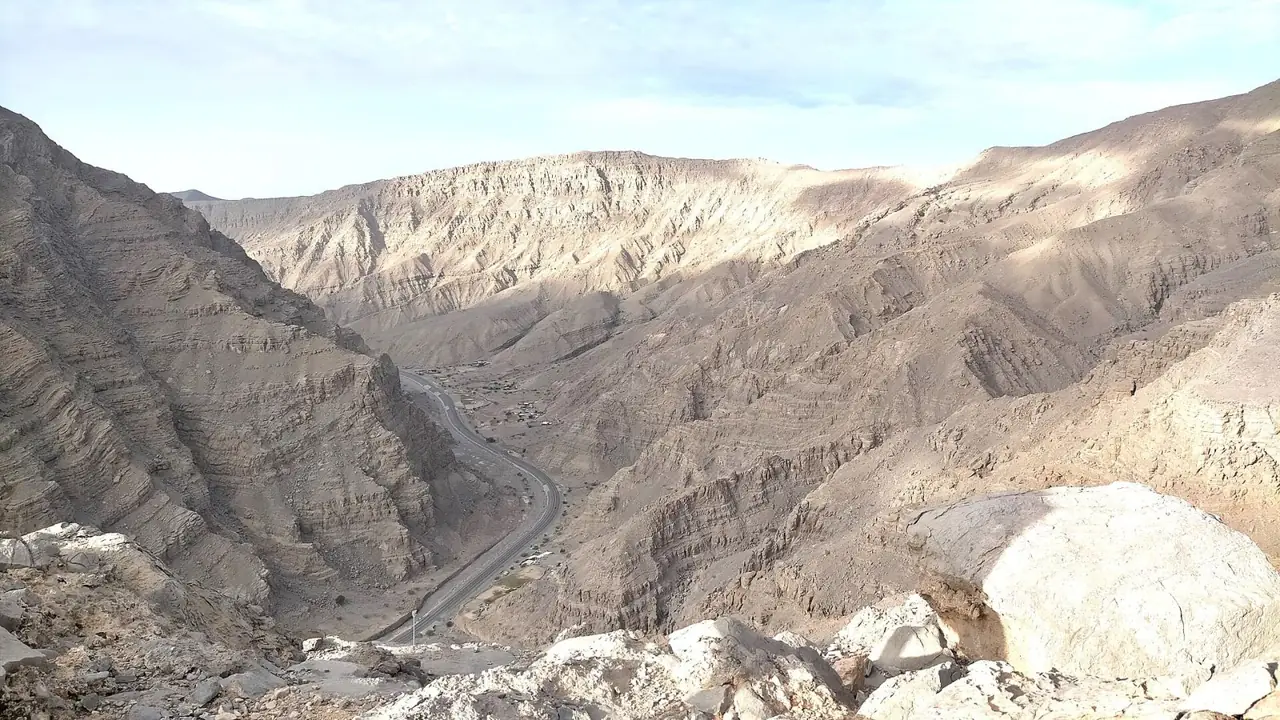
Wadi Shah is an 11.6km loop near Jebel Jais Base Camp that the operator grades Challenging, with steep ascents, rocky scrambling and a stop at the Hidden Oasis. It takes about 5 hours, is thinly waymarked and needs a GPS track, so it is a route for experienced hikers in the cooler months only.
Why it is graded Difficult
Visit Jebel Jais, run by RAK Leisure, grades Wadi Shah Challenging: steep ascents, rocky scrambling and a long, demanding route for experienced hikers.
We use one scale across all six routes: how we grade.
The route
You start near Jebel Jais Base Camp, by the Bear Grylls Explorers Camp, at about 450m above sea level. The operator says the loop begins with a steep ascent; walkers describe a gradual canyon of boulders first.
The ground turns rocky and the climb gets harder, with scrambling. The operator names the Hidden Oasis, a green patch among the cliffs, as the midpoint. Walkers advise keeping left at the first split. Waymarking is thin: stone markers and cairns only.
The loop returns to the start, so there is no turn-around point. Walkers describe a scree slope, then a steep, bouldery wadi descent and a final gravel track. The operator does not say which way round to walk.
- Distance
- Visit Jebel Jais gives 11.6km for the loop. Walkers and tour operators give 13km to 15km.
- Climb
- Visit Jebel Jais lists 'Elevation: 753 Metres' without defining it. Walkers' tracks give 700m to 783m of climbing.
- Time
- Visit Jebel Jais gives about 5 hours. Walkers report 6 hours, up to 10 with breaks.
Trailhead
- Start
- Near Jebel Jais Base Camp (Bear Grylls Explorers Camp) on the Jebel Jais road. The operator gives no exact trailhead.
- Coordinates
- 25.89987, 56.13984
The pin comes from one walker's blog and is accurate to a few hundred metres. - Parking
- Not confirmed. Walkers report parking at the camp. The operator describes no car park but says bring cash. Check with Visit Jebel Jais.
- Vehicle
- Not confirmed. A walker's blog says a 4x4 is not needed at the camp. Check with Visit Jebel Jais.
- Getting there
- Visit Jebel Jais says about 2 hours by car from Dubai, 45 minutes from Ras Al Khaimah city.
When to go
- Best months
- November to April, says Visit Jebel Jais. Do not walk it in summer.
- Start time
- Start by 8am for cooler temperatures and enough daylight, as walkers advise. Finish before dark.
- Shade
- Little. One walker's blog mentions a tree shelter in the lower canyon; the rest is open.
- Water
- None reliable on the route. Do not rely on seasonal pools. Carry all you need.
- Mobile signal
- Unknown. Signal can be spotty in the mountains, so assume none and download an offline map.
Fees, permits, hours and closures
- Fees
- Visit Jebel Jais says the trails are free to walk on your own. It gives no parking charge, only to bring cash. Last checked October 2026.
- Permits
- The operator says you do not need a guide, and no permit for Wadi Shah is listed. Groups over 10 must register in advance with RAKTDA, the tourism authority. Last checked October 2026.
- Hours
- No trail hours are published. The operator's FAQ says the mountain is open 24/7, which conflicts with the seasonal pause reported. Last checked October 2026.
- Closures
- Not confirmed. The operator says the trails are open, but a local guide site says they are closed, with no reopening date. Trail works are reported at the Hidden Oasis, the loop's midpoint. Ask the operator (info@rakleisure.com) or the camp (+971 56 501 5831). Last checked October 2026.
Checked on 6 October 2026. Rules and closures change, above all after rain: check the source pages below on the day.
Safety
- Do not start in or after rain. The route runs through a wadi, and water flows down days after rain.
- Do not walk in summer. The operator says temperatures can pass 40 degrees Celsius.
- Expect steep ascents, scrambling, scree and a narrow path with an exposed edge. You need a good head for heights.
- Some stretches have no defined path. Load an offline GPS track before you set off.
- Go with a companion, tell someone your route and return time, and do not rely on mobile signal.
- Check the trail is open before you drive up. Reports disagree.
What to carry
- At least 3 litres each; walkers advise 4
- Rehydration drink and food
- Offline map, compass or GPS
- Sturdy boots with good grip
- Sunscreen, hat and sunglasses
- First aid kit
- Charged phone and power bank
- Cash for parking
Tell someone your route and when you expect to be back. Turn around if the weather, the heat or the time is against you. We describe this route from published sources; we have not surveyed it, and nothing here is a statement that it is safe for you on the day.
Police 999 · Ambulance 998 · Civil Defence 997
What we could not confirm
- Whether the trail is open. Reports disagree, and works are reported at the Hidden Oasis.
- The exact trailhead and parking. The operator says only near Jebel Jais Base Camp.
- The climb figure. The operator's 753 metres is not defined.
- Waymarking. New signage is due this season, so markers may change.
Sources
- Visit Jebel Jais: Top hiking trails in Jebel Jais (Wadi Shah grade, length, time, elevation, trailhead, markers, all trails)
- Visit Jebel Jais: Jebel Jais hiking (public trails, no guide needed, guided walks from the camp, group rule, safety, emergency, trail works)
- Visit Jebel Jais: home page (seasonal pause posts)
- Visit Jebel Jais: 2025/26 season page (seasonal pause posts)
- Visit Jebel Jais: FAQs (open 24/7, drive times, fog and rain)
- Visit Jebel Jais: day trips from Dubai (Wadi Shah 11.6km, 4.75 hours, drive time, parking cash)
- Visit Jebel Jais: Bear Grylls Explorers Camp (no location data)
- Visit Ras Al Khaimah: Hiking (six trails 16km, head for heights, group notification)
- Visit Ras Al Khaimah: Bear Grylls Explorers Camp (at the entrance of Jebel Jais)
- The Road Reel: How to hike Wadi Shah (trailhead coordinates, route stages, 13km, 744m gain; published 2020, updated 23 September 2025)
- Adventure Faktory: Trekking Wadi Shah (parking, route, flood and guide comments; January 2018)
- Pushpitha, LiveJournal: Wadi Shah hike (13km, 1,194m high point; 11 November 2024)
- ECC Adventures: Wadi Shah (tour operator, 14.6km, 783m gain, vertigo warning)
- Adventure Quest: Hidden Oasis Shah Loop (15km, 700m ascent, 4x4 for final approach)
- Airial: Bear Grylls Explorers Camp (camp coordinates, parking, signal)
- WOW-RAK: Bear Grylls Explorers Camp (address Jebel Jais, Wadi Shehah)
- Dubai Family Leisure Guide: Bear Grylls camp (halfway up Jebel Jais, at Wadi Shehah)
- Wikipedia: Wadi Shah, Ras Al Khaimah (25 55 03 N, 56 08 26 E, 714m, abandoned settlement of Shah)
- WOW-RAK: Is Jebel Jais open right now (updated 14 September 2026)
- The National: Jebel Jais Grand Loop and trail rehabilitation (15 September 2026)
- Dubai Week: Marjan Lifestyle launches Grand Loop trail (3 October 2026)
- Gulf News: Jebel Jais 80km hiking loop (Wadi Khammed to Hidden Oasis rehabilitation, mountain rescue)
- WhatsOn: Jebel Jais 80km hiking loop (Wadi Khammed described as the Hidden Oasis)
- The National: Jebel Jais temporarily closed following UAE storms (23 December 2025)
- Ajman government: emergency numbers
- Wikimedia Commons: Category Wadi Shah (file pages and licences)
Last checked 6 October 2026 · Route 6 of 6 · www.sahraandbeyond.ae/h/6