
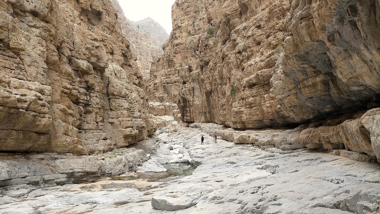
Jebel Yanas is a mountain above Wadi Naqab in Ras Al Khaimah with no official trail, grade or waymarks. Walkers use an unpaved road to the summit area, then follow orange-marked paths between mountain villages. It suits the cooler months, a 4x4 or high-clearance car and a guide if you have not been before.
Why it is graded Moderate
No official grade exists. Walkers rate the ridge walk as not very challenging to Moderate, and the gorge loops as Difficult. Moderate is the judgement for the main ridge walk; the loops are harder.
We use one scale across all our routes: how we grade.
The route
The usual walk starts at the end of the unpaved summit road on Jebel Yanas, reached by the Wadi Naqab road. One walker records about 13km out and back on a path marked with orange paint on stones: downhill on the way out, uphill on the way back, with a first viewpoint over the mountain villages after about an hour.
Other walkers have recorded loops through the villages and down into a wadi and gorge, with a short scramble up a rock wall and a steep loose climb out. One is rated Difficult by its author. Markings thin out after the village, so keep a GPS track loaded.
A steeper alternative climbs from Wadi Naqab to a locked green gate on a farm at the top. The author says the summit there is private property and advises not going past the gate. People live in the villages: stay out of buildings, fences and farms.
- Distance
- About 13km out and back, from one walker (MissionsOffroad). Variations are shorter and longer. No official figure.
- Climb
- Not confirmed. The climb from Wadi Naqab to the green gate is up to about 600m in under 3km, says its Wikiloc author.
- Time
- Not confirmed. About 1 hour to the first viewpoint; about 3 hours for one loop, from a commenter.
Trailhead
- Start
- The end of the Jebel Yanas summit road, reached by the Wadi Naqab road out of Ras Al Khaimah city.
- Coordinates
- 25.73256, 56.11286
The pin comes from a walker's blog and agrees with a second walker's track to about 40m. Check it on the ground. - Parking
- No official car park. Walkers report parking at the end of the road, or earlier on the road if the car cannot reach it. Not confirmed.
- Vehicle
- A 4x4 or high-clearance car is advised. The road is unpaved, with boulders and drop-offs. One blog says a sedan can probably reach the top; others say an SUV or 4x4.
- Getting there
- Visit Ras Al Khaimah says the Wadi Naqab trailhead is about 40 minutes from Ras Al Khaimah city and about 2 hours from Dubai. Time to the summit road is not confirmed.
When to go
- Best months
- October to April is advised for nearby Wadi Naqab. Do not walk it in summer.
- Start time
- Start early and finish before dark. Avoid midday, even in winter.
- Shade
- Little. The ridge is mostly in the sun.
- Water
- No source on the route. Carry all you need.
- Mobile signal
- Unknown. Assume none and download an offline map.
Fees, permits, hours and closures
- Fees
- No fee is mentioned in the sources opened. Last checked October 2026.
- Permits
- No Jebel Yanas permit was found. A 2023 report says walkers in Ras Al Khaimah must register at trail starts and cannot hike alone; it does not mention Yanas, so check before you go. Groups of 10 or more should contact the organisers of nearby Wadi Naqab in advance. Land at the summit of the Green Gate route is private property behind a locked gate (Wikiloc author), and people live in the villages. No right of way is confirmed. Last checked October 2026.
- Hours
- No hours are published. A security gate on the access road may ask you to sign in. Not confirmed. Last checked October 2026.
- Closures
- Not confirmed. No notice was found in October 2026. Walkers have reported a closed gate near the summit (February 2022) and a locked green gate in a farm fence at the top of the Wadi Naqab climb, where the Wikiloc author says the summit is private property. A security gate on the access road may also ask you to sign in. Ask RAKTDA or Ras Al Khaimah Police before you go. Last checked October 2026.
Checked on 8 October 2026. Rules and closures change, above all after rain: check the source pages below on the day.
Safety
- There is no official trail, rescue plan or waymarking. Go with a licensed guide if you have not walked it before.
- Do not go in or after rain. The National Center of Meteorology recorded 244mm at Jabal Yanas on 27 March 2026 (Emarat Al Youm), and the loops drop into wadis that can flood.
- Do not walk in summer. The ridge has little shade, and hikers have been airlifted with exhaustion or heat exhaustion in this area (March and May 2020).
- Police and Civil Defence rescues near Jebel Yanas were reported in March 2020, May 2020, May 2021 and November 2021, including a fall and a missing child. This is not a complete list.
- Expect steep loose ground, a rock wall and a final scramble on the gorge loops. Trekking poles are recommended. Stay out of farms, houses and fenced land, and do not open gates.
- Do not cross the border. Routes that go on to Jebel Tafif may approach it, and one walker's track from Wadi Bih describes white border posts there.
- Tell someone your route and return time. Do not rely on mobile signal, and do not hike after dark.
- The summit road has drop-offs. Drive slowly in a suitable vehicle.
What to carry
- At least 3 litres of water each
- Food and rehydration drink
- Offline map and GPS track
- Sturdy boots with good grip
- Trekking poles
- Sunscreen, hat and sunglasses
- First aid kit and head torch
- Charged phone and power bank
Tell someone your route and when you expect to be back. Turn around if the weather, the heat or the time is against you. We describe this route from published sources; we have not surveyed it, and nothing here is a statement that it is safe for you on the day.
Police 999 · Ambulance 998 · Civil Defence 997
What we could not confirm
- Where you may lawfully walk. Parts of the mountain are private farmland and the summit gate is locked.
- Whether the access gate is staffed, whether you must sign in, and whether trail registration applies.
- The distance, climb and time of each variation. Only one 13km figure was found.
- Current road and gate conditions. A gate near the summit was closed in 2022.
Sources
- MissionsOffroad: Jebel Yanas winter in the Hajar Mountains (trail start, viewpoint and camp coordinates, 13km, orange markers, 4x4 note; published 23 Feb 2020, modified 1 Jun 2024)
- twopassportspacked: Jebel Yanas (security checkpoint, road condition, closed gate near the top, car over the edge; visited Feb 2022, modified 5 Apr 2026)
- Wikiloc via loc.wiki: Jebel Yanas-Gorge-Wadi Loop (quarry-road gate and sign-in, vehicle advice, route, cemeteries)
- Wikiloc via loc.wiki: Jebel Yanas Loop - Mountain Villages and Gorge Scramble (Difficult, farm and old village site, scramble)
- Wikiloc via loc.wiki: Wadi Naqab to Yanas Green Gate (start coordinates, under 3km, 600m, locked gate, private property)
- Wikiloc via loc.wiki: Azabat Village on Yanas Mountain (start coordinates, residents, 4x4 note)
- Wikiloc via loc.wiki: Jebel Yanas-Sal village-Jebel Tafif Summit (one-way route to Tafif, 20m rope for a waterfall descent)
- Wikiloc via loc.wiki: Wadi Bih UAE to Jebel Tafif Oman (border posts, summit in Oman)
- Visit Ras Al Khaimah: Wadi Naqab hike guide (drive times, 4x4, no permit, groups of 10, flood and heat advice; dated 5 Mar 2026)
- Visit Ras Al Khaimah: UAE emergency numbers (dated 29 Sep 2022)
- Gigaplaces: Jebel Yanas (925m) (elevation figure, dirt road)
- Wikipedia: Wadi Naqab (cuts into Yanas Mountain; dam; flash floods)
- Wikipedia: Baqal, Ras Al Khaimah (village access on foot, trail from Wadi Naqab)
- Wikipedia: Shairi, Ras Al Khaimah (coordinates 25°41'22"N 56°05'18"E; reached on foot)
- Pinay Hakawati: RAKTRAV 2020 (FOX.AE group; day 6 Wadi Sal - Yanas Mountain - Wadi Naqab, 27.89km; not official)
- Emarat Alyoum, 28 March 2026: 244mm at Jabal Yanas on 27 March 2026 (NCM)
- Emarat Alyoum, 15 March 2020: air wing rescue in Shuairi area near Jabal Yanas (Arabic)
- Emarat Alyoum, 16 March 2020: same rescue, further detail (Arabic)
- Dubai Eye, 15 March 2020: man rescued from Jebel Yanis
- Dubai Eye, 30 May 2020: three exhausted hikers airlifted, 'Jebel Janas'
- Al Bayan, 22 May 2021: child missing in the Jebel Yanas area (Arabic)
- Dubai Eye, 30 May 2021: man honoured for helping find the child on Jebel Yanas
- Gulf News, 10 November 2021: injured Emirati man rescued from Jebel Yanis
- The National, 24 October 2023: new UAE hiking rules (RAK registration, fines)
- Khaleej Times, 20 February 2021: Dh10,000 fine for organising treks in RAK without a licence
- Gulf News, updated 5 December 2025: holiday hikers warned as RAK Police step up mountain patrols
- Gulf News, 2018: residents urged to contact police before mountain trips
- Wikimedia Commons: Wadi Naqab - 13.jpg (photo, CC0)
Last checked 8 October 2026